Pre-History
Since Mesolithic times the River Bann and Lough Neagh have been highways for mankind (friend and foe alike) into the heart of Ulster. The earliest record of Mesolithic man in Ireland is dated between 8,700 and 8,600 years ago. This has been deduced from fragments found near Mountsandel Fort approximately 1 mile (1.6 km) south of Coleraine and artefacts found at the exit of the Lower Bann from Lough Neagh at Toomebridge. These early inhabitants were nomadic, hunter gatherers. This makes the banks of the Bann one of the oldest inhabited places in Ireland!
Viking Raids
The first raids, in 795, met only with occasional resistance from the Irish kings who were merely successful in repelling their attacks on very few occasions. During the early raids the Vikings tended to stay within 20 miles of the coast. As they became more comfortable with the terrain they ventured inland, often using the rivers as highways. In the mid ninth century the Viking called Thorkils, whom the monks Latinised as Turgesius made his raids of terror up the Bann to Lough Neagh, hauling his long ships over the shallows at Portna. He sailed across Lough Neagh, from where he attacked Armagh and the surrounding countryside. Turgesius the Dane was later to exert his authority almost throughout the entire country and ruled most of Ireland from his fleets on Lough Neagh and the Shannon until his demise at the hands of O’Melaghlin (Malachy) the king of Meath. It is reputed Malachy drowned him in the waters of Lough Neagh in 845.
Recent History
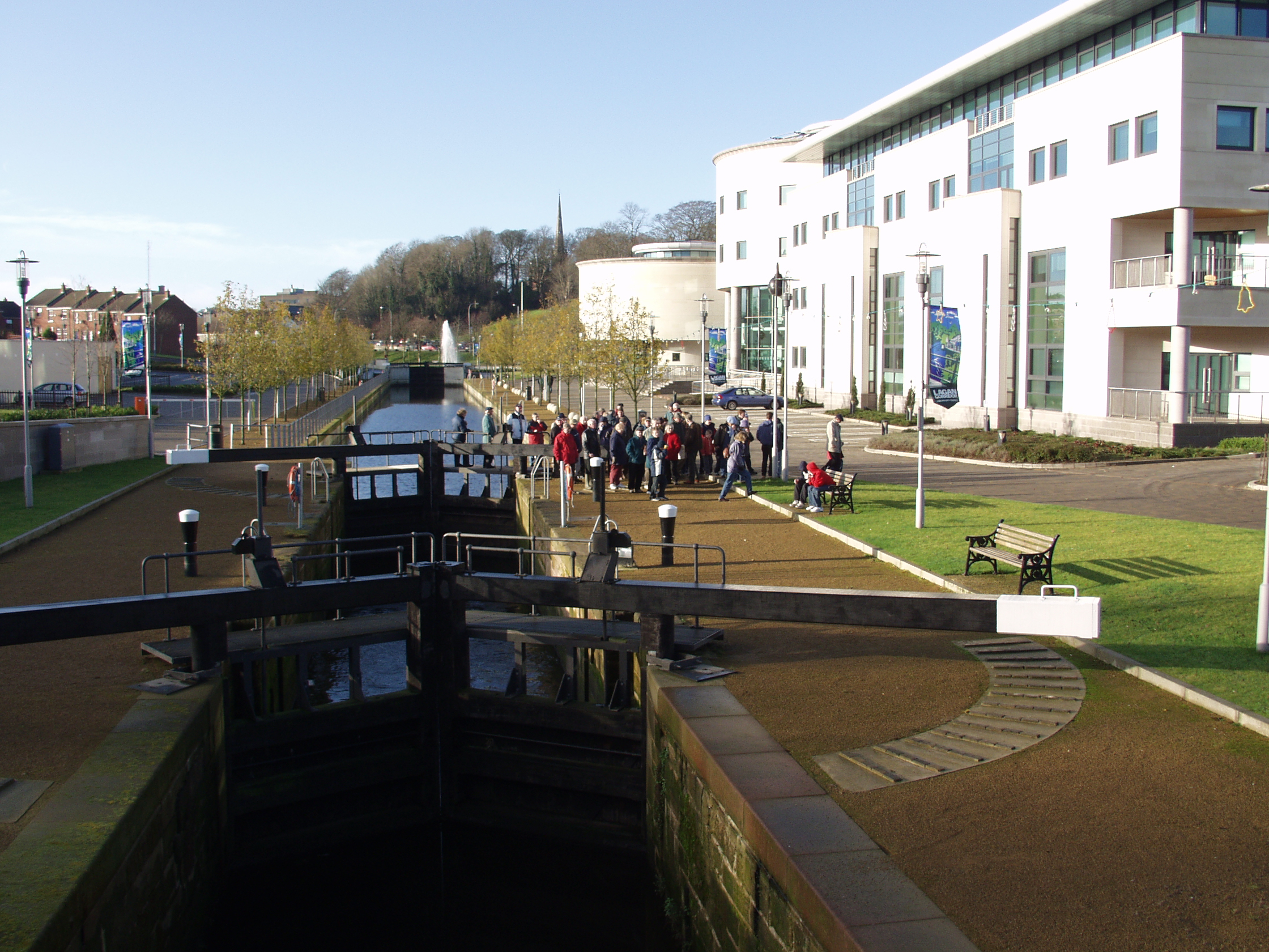
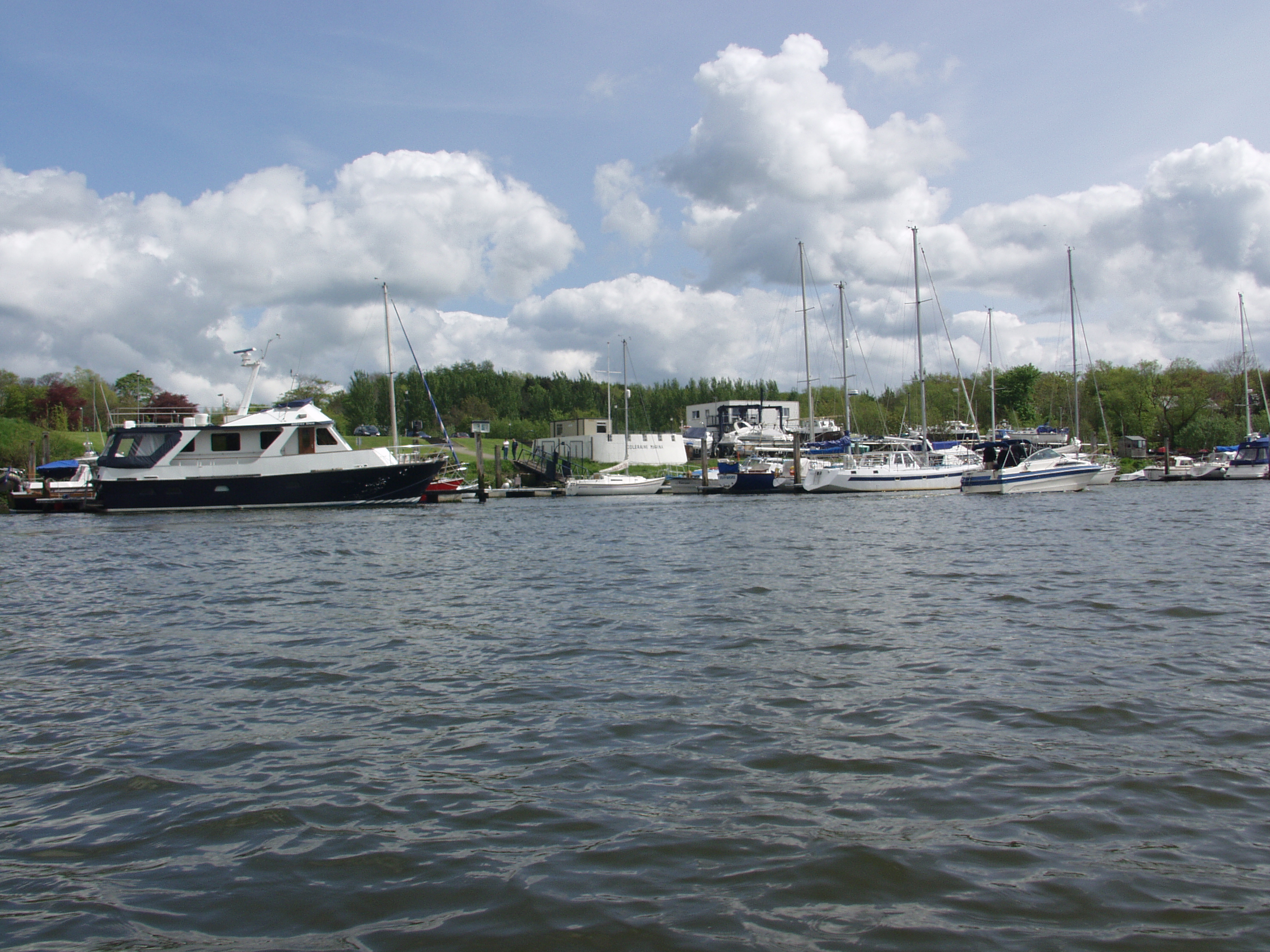
Lough Neagh, the River Bann, the River Blackwater, the Newry Canal, the Lagan Canal, the Coalisland Canal and the Ulster Canal once formed a massive transport infrastructure within the province of Ulster. Hundreds of thousands of tons of goods were transported by barge along these waterways every year. At one time the economy of Ulster revolved around the waterways. The coming of steam railways spelt the demise of this transport network but some parts were still used for freight until the 1950’s. The Lower Bann, the River Blackwater, and the Upper Bann are still in use and Lough Neagh has a large fleet of barges working at sand abstraction today. There is also a considerable fishing fleet working on Lough Neagh. Part of the Lagan Navigation has been reopened at Lisburn.
History and Archaeology
The Lower Bann and its banks reveal a particularly interesting story of early man in Ireland and some of its buildings dating from plantation times are of particular interest.
Mountsandel at Coleraine is the site of the oldest human settlement so far recorded in Ireland. These Mesolithic people lived as hunter gatherers 9,000 years ago and were drawn to the Lower Bann as a prolific source of salmon and eels. People exploited other sites
along the Lower Bann for salmon and eels in later Mesolithic times as well. Along the Bann stone and flint artefacts have been found and the Newferry/Culbane area is recognised as one of the richest areas for stone artefacts in the British Isles. Evidence of human activity was frequently associated with the diatomite deposits
laid down 7,500 to 5,000 years ago. Many swords, some of them richly decorated, dating from the late Bronze age have been found in the Lower Bann. Church Island at Lough Beg probably had religious significance even before the arrival of Christianity when it became, for a time, a monastic site. It is known to have been raided
by Vikings who must have travelled upstream. There are a number of significant plantation buildings along the Lower Bann, for example, Bellaghy Bawn and Movanagher Bawn.
The industrial archaeology of diatomite working along the Lower Bann is especially notable. For over a century diatomite was extracted, made into bricks locally or exported for other uses such as making insulation bricks, abrasives (car polish, toothpaste, etc.) and
filters (cider, beer production). The first diatomite factories were built at Newferry in 1906 and Portglenone in 1912. During the Second World War large quantities of diatomite were exported to English munitions factories to act as an absorbent for explosives (nitro glycerine). This period very much represented the high point
for the industry. Commercial extraction virtually ceased in the 1960s and finally ended in the mid 1990s. The former sites are now Sites of Scientific Interest.
Diatomite
Diatomite, or Bann clay as it is known locally, is made up of the remains of algae that grew in shallow flooded areas. The diatomite material is made up of the silica cases of many different species of diatom (green algae) that have decayed leaving only their hard outer cases behind. Diatomite occurs at locations all along the Lower Bann from Toome to the Ree downstream of the confluence of the Agivey River. The diatomite was laid down between 7,500 and 5,000 years ago in river embayments and shallow lake environments during the time when early people had colonised the area and before peat bogs had begun to form. The diatomite is important as a scientific resource while its exploitation is notable in the more recent history of the Lower Bann valley. Two diatomite localities have been designated as Areas of Special Scientific Interest.
Ulster Canal
The ultimate dream of all waterway enthusiasts is to be able to sail from Coleraine to Limerick. The missing link is the now derelict Ulster Canal. Built to link the Erne system and the Shannon with Lough Neagh its success was short lived. A poor water supply, inappropriately sized locks and the imminent arrival of quicker rail and road transport sounded its death knell. Now the economic prize is a different one, tourism, to bring much needed inward investment to a forgotten corner of our land.
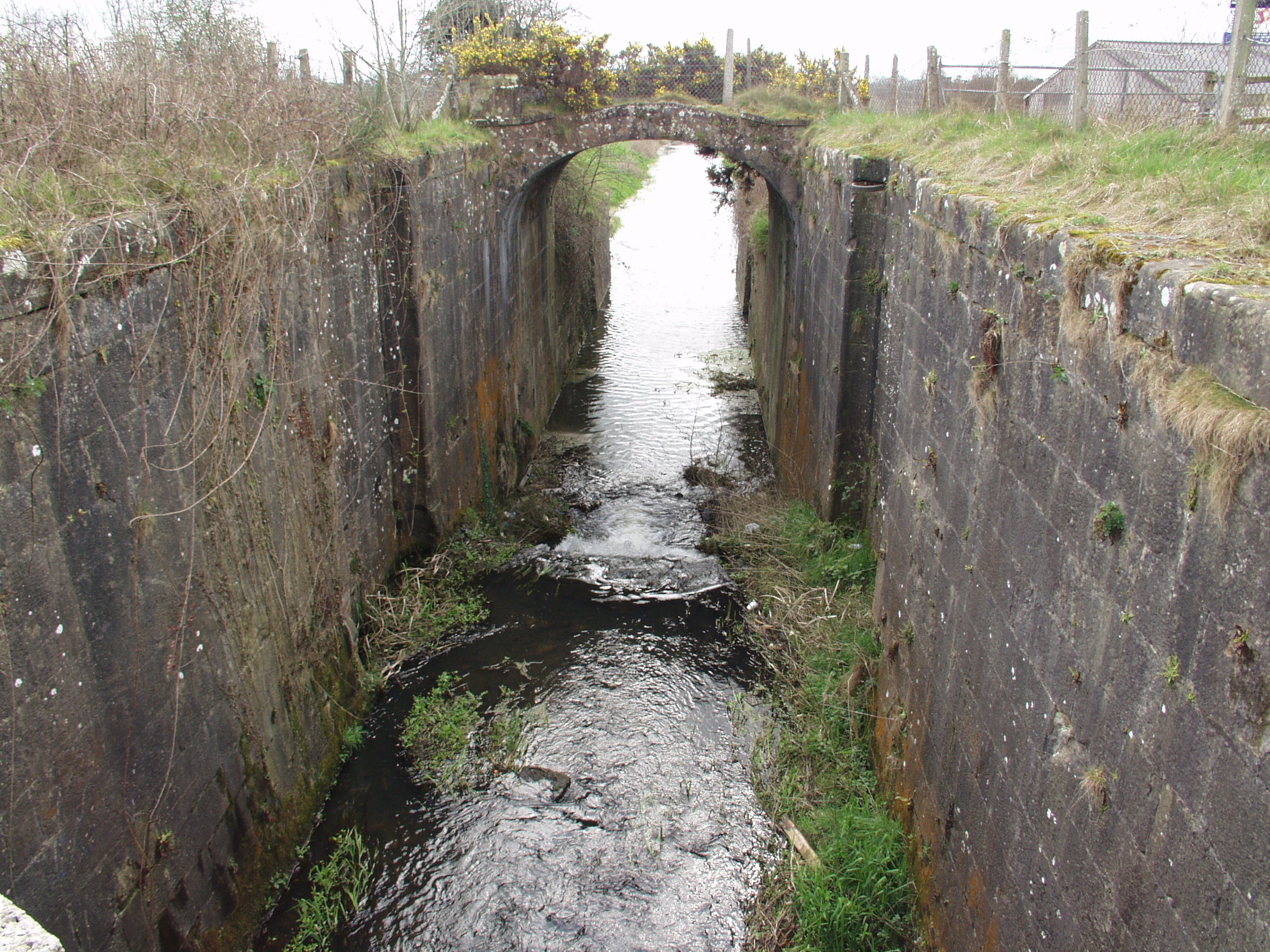
This canal, a small part of which has been reclaimed and can be seen at Milltown near Benburb, was opened in 1841. It opened up a direct link between Lough Neagh and Lough Erne. Its designers hoped that it would be a through route to the Shannon.
The Lagan canal had reached Lough Neagh in 1794 and as early as 1814 the engineer John Killaly was instructed to investigate the possibility of linking Lough Erne into the system.
Killaly envisaged a canal thirty-five miles long with twenty-two locks, built to the same dimensions as the Royal Canal. The principal reservoir for the summit level was to be Quigg Lough, a natural lake near Monaghan town.
It was considered a favourable time for a public works project as there was much poverty and emigration from the area. Despite public support and the backing of the local land owners progress was slow. Killaly died in 1832 and was succeeded by Telford and then Cubitt, working to, but modifying the original plans.
Cubitt was asked to cut costs and a decision was made to build the canal to narrower dimensions. The smallest lock was now to be 11ft 8inches (3.6 metres) wide, the narrowest lock in Ireland. This was to have disastrous consequences. It meant that most of the boats from other Ulster water-ways couldn’t pass through it. Most goods had to be transhipped causing delays and adding to freight costs.
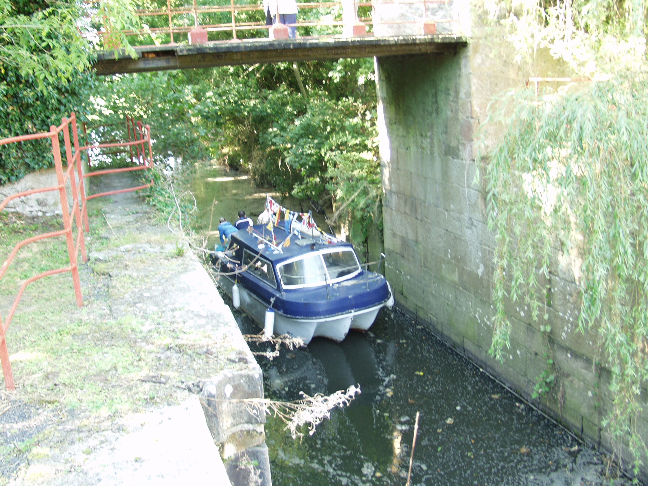
At Benburb the river Blackwater flows through a deep limestone gorge, a section that gave the builders of the canal particular difficulty. The canal was cut through the limestone for a distance of 350 yards and in one place to a depth of 41 feet.
The sides and bed were then lined with puddling clay and protected by a facing of rubble wall. For a mile the canal has a staircase of seven locks. The locks and bridges were built of fine quality Ashlar limestone, cut from a nearby quarry at Benburb. Indeed this quarry provided the stone for the landing quays, locks and bridges as far up the canal as Monaghan. The bridge and lock in the photograph is built of cut dressed stone to a very high standard of craftsmanship.
From the summit at Monaghan the canal dropped down through seven locks to join Upper Lough Erne at Wattle Bridge. The work was completed in 1841 at a total cost of £230,000.
Imperfect puddling and an inadequate water supply, particularly west of Clones in the summer months, became apparent almost at once. The anticipated traffic failed to develop. Only the Lagan and Newry Navigation systems enjoyed any degree of success. The waterways constructed in the 19th century had little chance against the growing popularity of the railways.
The engineering cheeseparing in construction precluding the passage of the larger barges in use on the Newry and Lagan systems, the inadequate water supply, the complete failure of the canal link through to the Shannon and the demographic changes brought about by the famine of 1845-47all contributed to the lack of success of the Ulster canal. By 1913 the Lagan navigation company had given up its struggle to maintain the canal and it became impassable beyond Clones. The partition of Ireland in 1921 accelerated the end. The last trading boat used the canal in 1929 and in 1931 it was officially closed and the land sold off.
The reopening of the Ulster Canal is the millennium project to illustrate co-operation and trust, the one that threatens none but benefits all. The canal is a gem, a forgotten cultural and heritage jewel. The reopening of the cross border Ulster Canal would bring significant cultural, economic and navigational benefits to a large number of people.
Coalisland Canal
The Coalisland navigation was one of the shorter waterways being about seven miles (12km) long. It linked the River Blackwater and Lough Neagh to the Tyrone Coalfields at Coalisland. Although short, it rises about 250 feet or 76 metres through seven locks and a series of dry hurries/wherries with quite an extensive basin at Coalisland. The distance of two and a half miles to the coalfields at Drumglass from Coalisland was fraught with difficulty. Tub boats were to be floated onto cradles and pulled by horses up the slope. Unfortunately this ambitious scheme was never really that successful. Sadly the Tyrone coal deposits proved to be of inferior quality and all too often coal was carried in the opposite direction. Despite the difficulties experienced the canal was a successful enterprise.
Lagan Canal
The building of the Lagan Canal was commenced in 1756 and within a year the first 6 miles from Belfast were completed. Problems abounded, mostly of a financial nature; regretfully it was to take a further 46 years to complete the project. The first engineer was called Thomas Omer who had first worked on the Newry navigation. The project was completed by Richard Owen, an engineer who had worked on the Liverpool and Leeds Canal. This was a successful waterway and carried much freight during both the eighteenth and early nineteenth centuries. Built to carry coal from the newly discovered coalfields of Tyrone to the expanding port of Belfast, it more often carried fuel in the opposite direction. It was finally abandoned in 1958.
Newry Canal
The Newry Canal is the oldest summit canal in the United Kingdom. Built between 1731 and 1742 it linked the Irish Sea via the Newry Ship Canal to Lough Neagh, the largest fresh water lake in Western Europe. It was built to transport the newly discovered coal near Coalisland to the merchants of Dublin. The pioneering engineer was a German immigrant called Richard Cassels though he was replaced by an English engineer called Thomas Steers. The Lagan Canal was a successful navigation, Newry being the fourth most important port in Ireland. Commodities carried included agricultural goods, tobacco, timber, iron goods, whiskey and oil products. The railway, which runs alongside the canal, was a factor in leading to its demise. The last vessel to sail the canal was a pleasure yacht in 1937.
T
he Lower Bann Navigation
As early as 1738 the Bishop of Down and Connor, Francis Hutchinson, suggested to the Irish Parliament that something should be done to reduce the annual flooding around Lough Neagh by removing the great shoal of rock at Portna, near Kilrea. Parliament agreed but nothing was done.
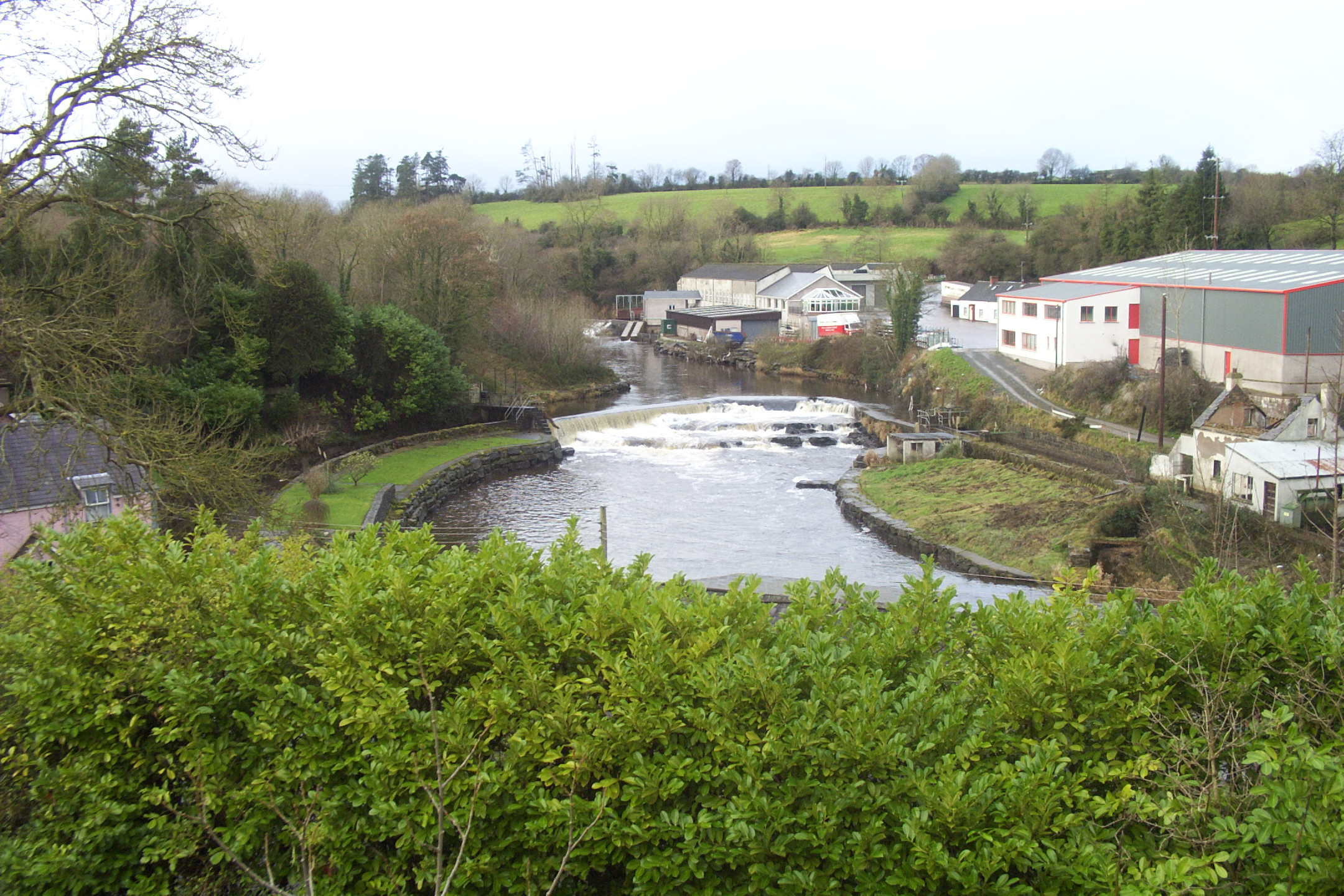
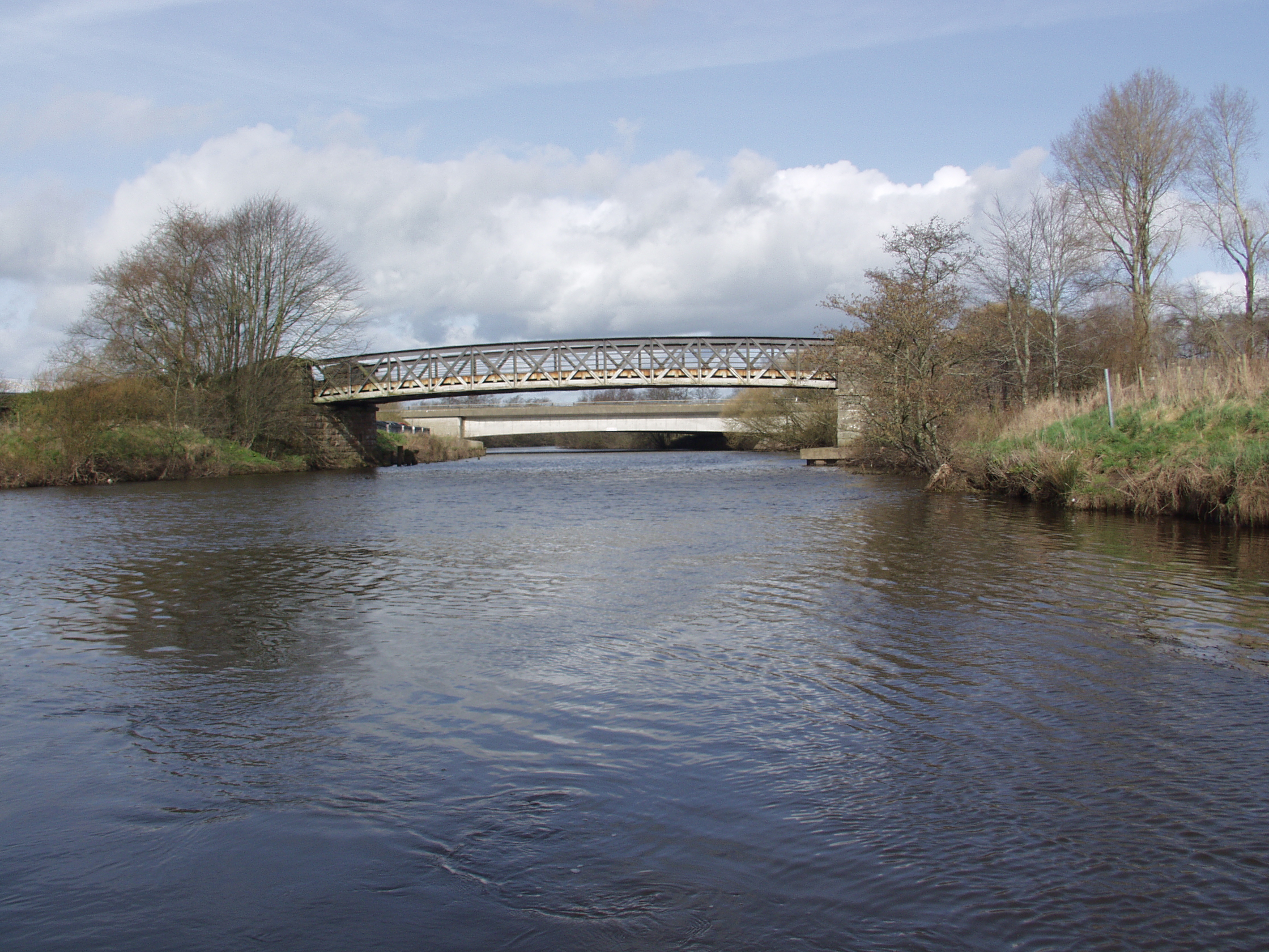
In 1842 a special act was passed enabling the Board of Works to improve navigation, drainage and mill power in the Lough Neagh Basin. In 1846 the Board of Works instructed its own engineer, John McMahon, to carry out a detailed survey and prepare an estimate of costs. He produced a plan, removing obstructions in the river thereby enabling navigation from Lough Neagh to the sea. The plan was approved and work began. However the work was hampered by shortage of labour caused as a result of famine and emigration. Railway construction too, competed for the available labour. Work continued for the next eleven years and a lock was installed at Toomebridge. The extensive shoal of rock at Portna was removed and a double-chambered lock installed to facilitate navigation. Three more locks were needed (Movanagher, Carnroe and the Cutts) to complete access to the tidal waters at Coleraine. Swing bridges and quays were constructed at a number of other places. The obstructions in the river were removed thereby lowering the level of Lough Neagh almost 6 feet (1.8m) at cost of £183,775.00. In recent years all but two of the swing bridges have been removed.
Despite all the works carried out to improve navigation, the Lower Bann was never to prove a commercial success, something common to so many river navigations. During the winter months the steam tugs available had not sufficient power to overcome the force of up to 800,000 cubic feet of water per minute passing down the Lower Bann.
In 1929, responsibility for navigation and drainage passed to Ministry of Finance who carried out further work to improve drainage. Floodgates were installed at Coleraine, Portna and Toomebridge to give greater control over the levels of water.
During World War Two the Lower Bann was used to transport munitions and supplies to and from the training and repair bases around Lough Neagh. The Lower Bann was also used to trial various amphibious craft for the war effort. The Royal Air Force, the Royal Navy and the American Army Air Force all had a large presence at bases such as Cluntoe, Langford Lodge, Toome and Antrim. A dry dock was built at Portna to service the barges used in these activities. A large jetty was built at Toome for transferring goods to and from the L.M.S. N.C.C. railway.
In the 1960’s the Lower Bann navigation was threatened with closure but thanks to a campaign organised by the River Bann and Lough Neagh Association in conjunction with other stakeholders the decision was aborted.
The Future
The future for the River Bann and Lough Neagh system looks bright with increased use by pleasure boats. Even more success could come with the reopening of the Ulster Canal and the other associated canals of the Lough Neagh basin. Coleraine could well become the mecca for boating tourists from Belfast, Dublin, Enniskillen, Limerick and Waterford.
created with
WordPress Website Builder .