
Contributions for this page always welcome on any subject
The Lower Bann: A Great Water Highway the late Victor Hamill, Chairman RBLNA -with acknowledgements to Wallace Clarke
Halfway along the north coast of Ireland lie the seaside resorts of Castlerock and Portstewart. Between them lies the tidal estuary of the River Bann, which enters the sea at the Barmouth. The river entrance is relatively safe for small boats but is not for the faint-hearted in strong northerly or north-westerly winds.
The river is famous for its salmon and the estuary is pretty, with sand hills on each side, containing fine golf courses and rich agricultural land. Seaton's Marina lies approximately three miles upstream on the east bank. Diesel and water are available, together with berthing and lift-out facilities and advice about the river. The public marina lies further upstream, also on the east bank, and has good basic facilities for visitors.
Five miles up lies the university town of Coleraine. St Patrick built a church here in the fifth century and the town is one of the leading plantation towns, and well worth a visit. Coleraine has a harbour with a 30-tonne crane, good quays and boat-storage facilities. Just above the harbour, headroom at the town's stone bridge is restricted to 13' at low water.
The river is tidal for two miles above Coleraine to the sea-lock at the Cutts, just upstream of the great earth fort at Mountsandel on the east bank, a site of archaeological importance that rises majestically out of its pine trees. There is a small jetty to enable visitors to tie alongside for short stays.
The locks will take boats up to 120' X 20'; the river will take boats drawing up to 4'. In the 32 miles up to Lough Neagh, the river rises 40' but if the massive floodgates are open more than 18" at the Cutts there is a 4' fall in the stretch of a mile above them. Great care is needed at this point in flood conditions.
Just above Loughan Island, on the east bank, lies the relatively new Drumaheglis Marina, run by Ballymoney Borough Council, which has camping and caravanning facilities. At Portna, near the town of Kilrea, 16 miles from Coleraine, there is a dry dock above the upper lock, which blocks the channel when in use. Fortunately this does not happen very often and is advertised in the press in advance. The locks at Portna lie on a short canal west of the river.
Portglenone is a further 7 miles upstream and boasts a new marina with a pub and shops within easy reach. The forest here has many riverside walks and the scenery is serene. The fishing here is arguably the finest in the whole length of the river.
Four miles upstream the voyager comes to Newferry, where there are facilities for tying up on both sides of the river before entry to Lough Beg (3 miles long by 1 across). Navigation is marked by perches and leads to Toome, at the entrance to Lough Neagh, which has a jetty where it is possible to tie up and buy provisions.
Through the lock at Toome lies Lough Neagh, an inland sea 17 miles X 11 miles: the largest inland lough in the British Isles. Lough Neagh and its hinterland are strong in character and traditions. In fine weather the water becomes a blue mirror and at sunset the whole lough often resembles a sea of molten gold.
There is a newly refurbished marina at Ballyronan on the west bank. Other places of interest are Coney Island, Ardboe Battery, Kinnego Marina, Castle Bay and Rams Island. It is possible to visit Antrim and to navigate the River Blackwater from Maghery.
Lough Neagh requires care in strong winds because the waves are short and steep. Sand dredging is an important commercial activity and there are many fishermen who earn a living catching pollan, a freshwater herring peculiar to Lough Neagh.
The prospect of reopening the Ulster Canal between Lough Neagh and Lough Erne, and on to the Shannon, is eagerly awaited. It will provide the missing link between these important waterways with all their tourist potential, which will in turn provide opportunities for further
economic development.
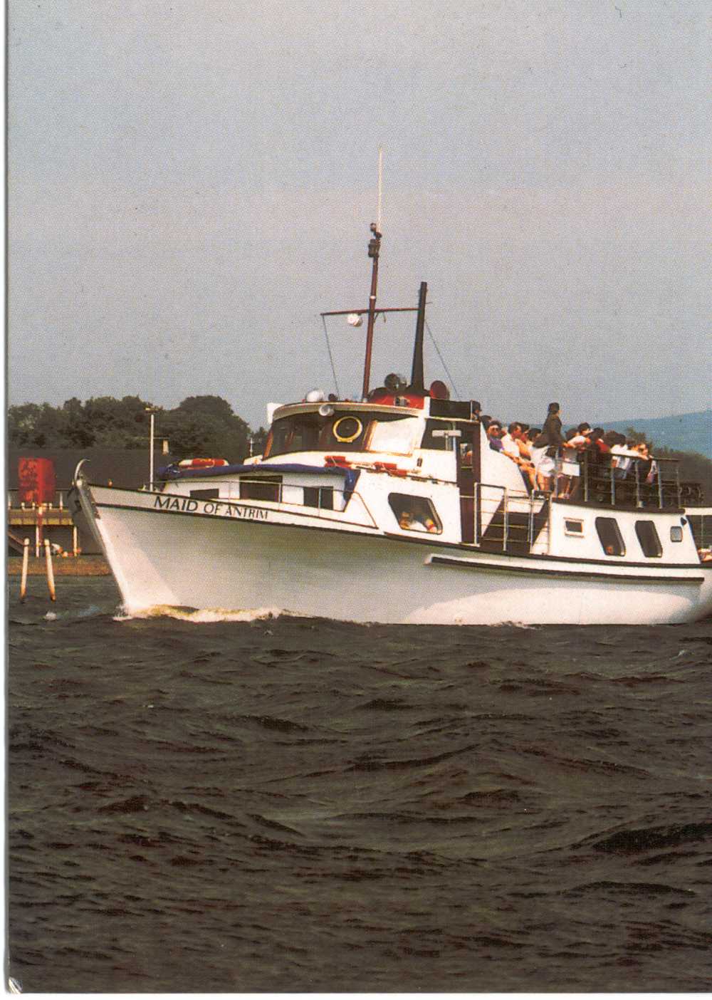
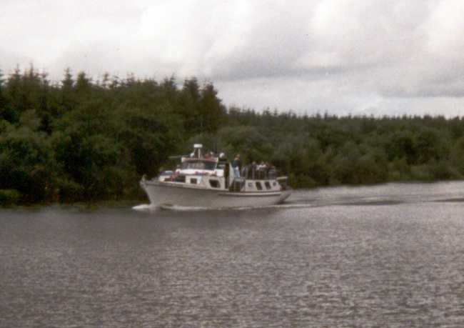
Maid of Antrim by Jim McGarry
Looking out across Lough Neagh on any day between Easter and 31 October, any year from 1967 until 1998, you would probably have seen the passenger vessel Maid of Antrim sailing on one of her thousands of one-hour cruises or on a chartered booked cruise of anything from two hours up to an all-day special. Her classic lines and easy gait distinguished her from any previous passenger vessel that plied on Lough Neagh. During her 32 consecutive years cruising she became part of the Lough's history and outstripped previous attempts to run a similar operation by 28 years.
The Maid of Antrim was built on the Clyde in 1963 and ran for two years out of Queensborough up the Gareloch and Holy Loch; she was then called the Scots Guard. She was bought in 1965 by John Rainey of Larne and operated at Antrim in 1965 and Carrickfergus in 1966. She returned to the Clyde in the winter of 1966 and was hauled ashore in McAllister's Yard at Dumbarton.
George and James McGarry of the long-established boatbuilding and marine contracts family firm of H McGarry & Sons, Ardmore Boatyard, flew immediately to the Clyde to secure the vessel when she was put up for sale in May 1967. The annual overhaul and certification of the hull took place in Scotland. After launching, the vessel - with an Ardmore Boatyard crew - was forced to lie in Gourock Harbour during two days of a westerly gale and heavy rain. A few days later, after a successful crossing of the Irish Sea, the Board of Trade engine and buoyancy certification took place at Toomebridge.
Her first cruise was from Toome to Coney Island on Saturday morning 16 June 1967; she spent the remainder of that day running one-hour cruises from Coney Island Festival through a Lough surface thick with green algae: that was the infamous summer of algal blooms that started the chain of research and remedial works still being carried out today by the Dept of Agriculture. The family crew slept aboard (the first of many such overnight operations) at Coney Island and made passage to the Sixmilewater on Sunday in time to operate one-hour cruises starting at 2.00pm.
For the next 32 years the Maid was full-time during the summer months, operating all cruise permutations imaginable to make the best use of the existing harbours and islands. The highlights of each season were the weekends, usually four off, when she took passengers down the Lower Bann to the Cutts on the Saturday, and returned with a fresh party on the Sunday to the Sixmilewater. Late-night party bookings - which included barbecues on Rams Island or Coney Island, Ballyronan, Cranfield, The Gaugers, The Battery, Maghery, Toomebridge and Portglenone - were quite successful given reasonable weather. High winds and river floods were, of course, the cause of many party cancellations.
Disaster overtook the Maid and her family crew on 6 September 1974 when James Jnr (aged 17) was lost overboard during a night cruise. His body was not recovered until ten days later near Hutton's Point. This family tragedy almost spelt the demise of the Maid of Antrim's operation at that time - but for the tenacity and foresight of the remaining young family, who voted to carry on in recognition of the work and interest that James had put into the operation.
And so it was that during 1975 and 1976 the Maid was taken out of the Lough for cruises on Lough Foyle for two weeks in May and two in September, giving the crew a welcome and interesting change of venue - and the local residents a chance to view the city and surroundings from their own beautiful Foyle river, which had been without a permanent passenger cruise vessel for many years. The remainder of those years were spent as usual on Lough Neagh.
At the end of 1977, the McGarry family crew members were finishing their education and ready to move into their respective career fields, so they would not be available as crew members. It was time to sell the Maid. She was bought by Antrim Borough Council and continued plying cruises until the end of 1998, exclusively on Lough Neagh except for a two week visit to Belfast Lough in July 1991 to coincide with the Tall Ships visit. In all, she gave a total of 32 consecutive years of sterling service, providing locals and visitors with the opportunity to see our largest Lough and unique Lower Bann river at close quarters and in relative comfort. She had, in those years, become part of Lough Neagh's attraction and history - and something of a pet to those who crewed and skippered her!
note: At present the Maid is standing on shore being refurbished. It is hoped that that this beautiful little ship will sail again soon.
The Upper Bann by Michael Savage
The Upper Bann enters L Neagh about 1.25 miles south-east of Coney Island flat. The entrance is shallow and not properly marked or maintained. Entry should not be attempted without local knowledge. A quarter mile upstream is the site of the old Bann Ferry, which no longer operates. The jetties can be used for a short stop. The villages of Charlestown (Bannfoot, east bank) and Columbkille (west bank) can be visited by a 10-minute walk.
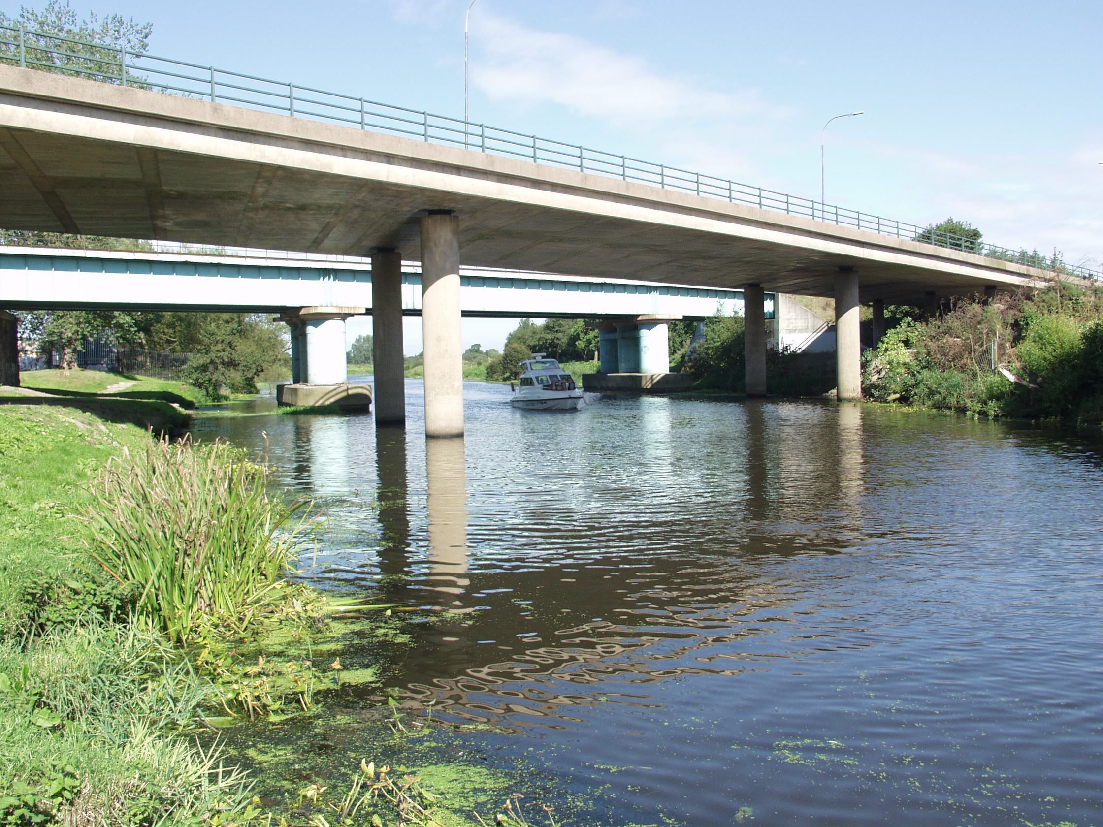
From the Bann Ferry the river meanders deep and wide through the open meadows of its flood plain, for 6 miles to the M1 motorway bridge. The air draft at this bridge is 3.050m on the north soffet and 3.075 on the south, assuming a Lough Neagh level of 12.5m OD. A change of wind direction on L Neagh can cause the river to back up and reduce the air draft.
Once through the bridge the river becomes more enclosed. Three miles south is Shillington Quay in the heart of Portadown, with jetty (only 0.6m depth) and slipway; there is another jetty, with the same depth, about half a mile upstream, behind a supermarket. The town, about 5 minutes walk, has all the usual facilities: refreshments, takeaways, garages etc. There are three bridges in Portadown centre but all are higher than the M1 bridge.
One mile upstream from Shillington is the Point of Whitecoat, where the Newry Canal and the river Cusher join the Upper Bann. The Bann is navigable for another half-mile beyond this point. The Newry Canal is navigable by dinghy from the Point to Moneypenny Lock, about 1 mile. The canal is very weedy in summer but has ample water until about 100m from the lock. It is well worth the effort to bank moor, and either walk the towpath or travel by dinghy to Moneypenny. The lock is in remarkable condition for its age.
created with
WordPress Theme Builder .